Byron Hinterland History Guide
Middle Pocket History Guide: Cedar, Dairy Farms And Valley Stories
Middle Pocket looks like a quiet green valley today, but the hills behind Mullumbimby and Billinudgel carry layers of story: Bundjalung Country, cedar rafted down the Brunswick River, a railway that arrived in 1894, one-teacher schools, cream cans and banana slopes, and a power station that turned 100 this year. This guide shows you where to find that history on a relaxed spring stay, which stops are worth the drive, and how to make it interesting for everyone in the car.
Key Takeaway
Middle Pocket sits in the Byron Shire hills on Bundjalung Country, in a landscape cleared by cedar getters, opened up by the 1894 railway and farmed for dairy and bananas for most of the twentieth century. A short loop through Mullumbimby, Billinudgel and Brunswick Heads lets you see each chapter without long drives.
Before You Set Out
Several of the best history stops keep short or volunteer-run hours, so a little checking saves a wasted trip.
Three Easy History Outings
You do not need a full itinerary. Pick one of these per day and keep the rest of the time for the creek, the pool and the garden.
Why Middle Pocket's History Is Worth A Few Hours
Middle Pocket is a small rural locality in Byron Shire, with a population recorded at 138 in the 2016 census and the same 2482 postcode as Mullumbimby. There is no main street, museum or monument here, and that is part of the appeal. The history is written into the land itself: cleared ridges that were once rainforest, flats that were once dairy paddocks, and creeks that once carried timber and cream towards the coast.
Most visitors come to the Byron hinterland for the green hills, swimming holes and easy access to the beaches. A history angle adds something different to the same trip in spring: a café stop in Billinudgel becomes a stop in a railway town, and a walk around Mullumbimby becomes a walk through a town that once ran its own council and its own power station.
Start With Bundjalung Country
Every part of this story sits on Aboriginal land. The Bundjalung people are the traditional owners of the Brunswick Valley, and published local histories name the Minjungbal people of the Bundjalung nation as traditional owners around Billinudgel, with the Arakwal people associated with Brunswick Heads and the coast. Long before it was called the Brunswick River, the river was known as Durangbil.
Several local place names come from Bundjalung language. Billinudgel is most commonly traced to Bilihnadhihl, often given as "place of the king parrot" or "once belonged to a parrot". Mullumbimby is traced to mulubinba, a word for a small round hill, and possibly also a local native fern.
Mount Chincogan, the distinctive peak beside Mullumbimby, is described as a minor lava plug of the extinct Tweed volcano, with Wollumbin (Mount Warning) as the main plug. It is also recorded as a sacred women's site for the Bundjalung. Enjoy it as a landmark from the town and the roads, and treat it as a culturally significant place rather than a tourist summit.
What "Pocket" Means: Reading The Landscape
The Pocket is named for the way the village sits between hills, and the same idea fits Upper Pocket and Middle Pocket. Hills near The Pocket rise to around 400 metres, and the Mount Jerusalem ranges to the west climb to roughly 700 metres. Each "pocket" is a sheltered patch of flat or gently sloping land between those ridges, which is exactly the kind of country early farmers wanted for houses, paddocks and water.
Water explains a lot. Marshalls Creek, the north arm of the Brunswick River system, flows through The Pocket, Billinudgel and Ocean Shores before meeting the main river near the coast.
When you drive in and out of Middle Pocket, look for the pattern: steep timbered or regrowth slopes on the ridges, cleared paddocks lower down, houses near the flat ground and the creek lines. It is a landscape shaped by more than a century of farming decisions.
Cedar Getters And The River Road To Sydney
The first recorded European look at this coast came in 1828, when Captain Henry Rous charted the Brunswick River. More than 20 years later the cedar cutters arrived, and their work drove the first European settlement.
Red cedar from the Big Scrub, the great lowland rainforest of the Northern Rivers, was valuable timber. Around Billinudgel, settlement from the 1840s was mainly cedar getters who felled and milled the trees. The timber was rafted down the Brunswick River to Brunswick Heads and then shipped to Sydney. At Mullumbimby, a European camp at the junction of two arms of the river in the 1850s grew into a village and later a township, and the town began as a timber centre.
The cedar trade did not last. Once the accessible trees were gone, the timber economy collapsed and the valley turned to farming. That shift, from logging to dairy and bananas, is the reason so much of the country around Middle Pocket is open paddock rather than unbroken forest.
The Railway Arrives: Billinudgel In 1894
The single biggest change to life in the Pocket valleys came with the railway. Construction of the line began in 1884, and the section through Billinudgel was completed in December 1894. The next section to Murwillumbah opened on 24 December 1894, and Billinudgel was one of the stations on that stretch, alongside Mooball, Burringbar, Dunbible and Murwillumbah.
The railway made it far easier to move goods to market and created local jobs. After it opened, many local farmers took up dairying, and from the 1920s banana farming developed as well.
Billinudgel station closed on 11 November 1980. Passenger services on the wider line lasted longer: the NSW Government closed the line in April 2004, and the last XPT left Murwillumbah station on 15 May 2004. Parts of the old corridor are now being turned into the Northern Rivers Rail Trail.
Billinudgel's Old Hotel And Railway Village
Billinudgel sits between the Pocket valleys and the coast, and it is a good place to see how a railway reshaped a settlement. Its earlier names included Grahamtown, changed to Hainsville in 1891. "Billinudgel" was in use by 1876 in various spellings and was formally gazetted in 1919.
The village's first hotel, the Tramway Hotel, was built in 1892 to serve the railway workers. It burned down in 1898, was rebuilt, and burned again in September 1906. It was renamed the New Brighton Hotel in 1914 and became the Billinudgel Hotel in 1995. If you stop in the village, the pub's long history is a nice story to share over a drink or a counter meal. Check current trading hours before you go.
Billinudgel Public School opened in 1893 and closed in 1993, almost exactly a century later. The village was also on the old Pacific Highway until the highway was bypassed in July 2007, which is part of why it feels quieter now than its location might suggest. The 2021 census recorded 261 people living there.
One-Teacher Schools: The Pocket Communities Grow
The history of The Pocket Public School is one of the clearest records of how the Pocket valleys grew. On 23 June 1900 a contract was signed with Joseph Yates of Byron Bay to build a school on half an acre leased from John Torrens. The building was finished on 6 October, and the Upper Pocket Provisional School opened in November 1900. Its first teacher, 20-year-old Arthur Clarke, was appointed on 2 November 1900.
By 1907 attendance reached the 20 students needed for public school status. The grounds were enlarged to two acres in 1909, and a new building, still in use today, was completed in 1920, with a basket picnic marking the opening.
Middle Pocket had its own chapter. As the population grew, the Middle Pocket community was granted its own school in 1922, and its first teacher was appointed in October 1927. For four decades Middle Pocket children learned close to home, until the Middle Pocket school closed in December 1968 and its teacher was withdrawn.
Small details in the school history bring the era to life. Electricity was only connected to the Pocket school in 1954. Through the middle of the century enrolments stayed between about 20 and 35, a reminder of how few families worked these hills.
From Cream Cans To Lifestyle Blocks
For much of the twentieth century this was dairy country. The school's own history records that the closure of the Norco factory in Byron Bay moved the area away from dairying. Farms were subdivided into smaller lots and sold to people looking for a rural lifestyle.
That change explains the valley you see now. Instead of large single dairies, there is a mix of small farms, family acreages, orchards, gardens and holiday stays. Enrolments at The Pocket school began a sustained rise from 1987 as new families moved in, and the school grew from a small rural school into a larger one with new buildings in 1989, 2000 and 2010.
Almost every property in the Pocket valleys is a private home or farm, so enjoy it from the road, stop only in safe places and never enter land without permission.
Mullumbimby: The Valley's Old Town Centre
Mullumbimby is the town that served the Pocket valleys, and it is the best place to see the district's history in one compact area. It lies about 5 km west-south-west of Brunswick Heads and about 15 km north-west of Byron Bay, a short drive down from the hills.
Mullumbimby was its own municipality from 1908 until 1980, when it was amalgamated with Byron Shire. Byron Shire Council's offices moved to Mullumbimby in September 1996, so the old town is now the shire's administrative centre. Its population has grown from 1,329 in 1921 to 3,589 in the 2021 census for the town and surrounding area.
Traditionally the district's notable products have been beef, dairy, bananas and sugar cane. Smaller farms have since diversified, and you can see that change most clearly at the Mullumbimby Farmers Market, which has run every Friday since 2010 at the Mullum Showgrounds on Main Arm Road, from 7am to 11am. It is a good modern bookend to the farming story: the same valley, a very different set of producers.
The Brunswick Valley Museum: The Best Single Stop
If you only do one history stop, make it the museum run by the Brunswick Valley Historical Society at 17 Myokum Street, Mullumbimby. The main building was Mullumbimby's first post office, built in 1907, and it was relocated to its present site in 1984.
The museum sits in Summers Park, which also has a replica slab cottage. Inside are local history memorabilia, photographs and documents covering the social, economic and civic history of the Brunswick Valley. Outdoor exhibits include equipment from the local railway, the hydro power facility and the brick works, along with two drays. For families, the outdoor pieces and the slab cottage are often the easiest way in.
Hours are short, because the museum is run by volunteers. Museums and Galleries of NSW lists it as open Tuesday and Friday from 10am to 12pm, plus 9am to 1pm on the third Saturday of the month, which is market day, with other times by appointment. Entry has been listed as a gold coin donation. Phone (02) 6684 4367 to confirm before you go.
Mullumbimby's Hydro Station Turns 100
One of the more surprising local stories is electricity. Mullumbimby's council built its own hydro-electric scheme using water from a weir on Wilsons Creek. Consulting engineer William Corin, who later worked on plans for the Snowy Mountains Scheme, was engaged in 1923 and construction began in 1924. Electric lights first switched on in December 1925, and the power station was officially opened on 6 March 1926.
That makes 2026 the station's centenary. Local historian Susan Tsicalas has described it as just the third municipal hydro-electric scheme in Australia, and it supplied Mullumbimby, Byron Bay and Bangalow. It was connected to the wider grid in 1938, generation largely stopped in the 1960s, and the station was decommissioned in 1990. It was added to the NSW State Heritage Register on 27 June 2014.
There is no public access to the station itself. Its owners, Essential Energy and Byron Shire Council, do not allow entry beyond the gates and fencing. The easier way to connect with this story is the museum, which holds equipment from the hydro facility among its outdoor exhibits.
Brunswick Heads: Port Town, Woodchop And Footbridge
Brunswick Heads is where the timber story met the sea. Cedar cutters' activity led to the creation of the first town in what is now Byron Shire, and by the 1880s Brunswick Heads was a busy port with a small commercial centre. The village was first proclaimed as Brunswick on 20 March 1885, and the name Brunswick Heads was officially adopted on 2 July 1971. The river itself was named in honour of Queen Caroline of Brunswick.
A favourite piece of local history is the woodchop. It began in 1928 as a way to raise money for a footbridge from the village across to the surf, and that footbridge officially opened on 31 January 1937. It is a lovely example of a small town building what it needed through its own events.
Today the southern bank of the river has a harbour and small marina for fishing boats, and Torakina Beach sits within the breakwater. It is easy to combine a short history walk with a river swim or fish and chips, after checking current conditions and council notices.
Mount Jerusalem: The Ranges Behind The Pocket
The Brunswick River rises on the eastern slopes of Mount Jerusalem, near Uki, and flows about 34 km to the sea at Brunswick Heads. The ranges you see west of the Pocket valleys are part of that catchment, and much of the high country is now protected as Mount Jerusalem National Park.
NSW National Parks describes the park as lush rainforest and tall eucalypt forest in the Byron hinterland, with subtropical and warm temperate rainforest along the creeks and threatened species including Albert's lyrebird and the red-legged pademelon. Listed walks include the Whiskey Creek walk, the Unicorn Falls walking track, the Rayners walking track and the Gidjuum Gulganyi Walk.
The rainforest here hints at what the Big Scrub country looked like before it was cleared. The park is always open but may close at times due to poor weather or fire danger, so check NSW National Parks alerts before driving out.
Making Local History Fun For Kids
History lands best with children when it is physical. The slab cottage and the outdoor railway and hydro equipment at the Mullumbimby museum give them something to look at and talk about, rather than only reading panels.
Give them a mission for the drive: spot Mount Chincogan, find the Billinudgel road sign and talk about the king parrot, or imagine timber rafts coming down the river at Brunswick Heads.
Back at a farm stay, chickens, eggs and a walk to the creek are a small, real link to the way Pocket families lived. A chat about the one-teacher school can stick far longer than a museum label.
Why Figtree Creek Retreat Suits A Valley History Stay
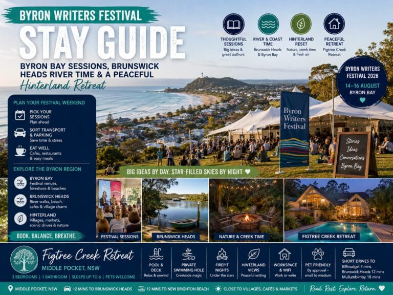
Figtree Creek Retreat is a three-bedroom cottage in Middle Pocket that sleeps up to six guests. It suits this kind of trip because the property itself is part of the valley story: it has a creek on the property with a swimming spot, lush green surrounds, a chicken pen and what the listing calls a "farm sweet farm" setting. Guests mention morning chats with the chickens and fresh eggs and oranges from the property.
After a morning in Mullumbimby or Brunswick Heads, the house gives you an easy afternoon. The listing shows a pool and pool deck, an outdoor fire pit, an infrared sauna with a bucket pull to cool down, hanging chairs, an outdoor swing, outdoor daybeds and play equipment for the kids. An outdoor movie night is offered at extra cost.
Inside, the upstairs A-frame living and dining area has a bright open-plan kitchen and a hanging daybed. Downstairs there is a king master bedroom, a queen bedroom, a room with a custom-built bunk bed and a dedicated office space, plus a bathroom with a bathtub, shower and double vanity. A private balcony looks out over the valley.
The WTP listing includes pets among its features. Confirm approval, conditions and any fees before booking, and check local rules separately for any beach, market or park you plan to visit with a dog.
Where Figtree Creek Retreat fits a valley history weekend
Figtree Creek Retreat puts you in the middle of the Pocket valleys' farming story, with a creek on the property, a chicken pen and lush green surrounds. A morning at the Mullumbimby museum or in Brunswick Heads pairs easily with an afternoon by the pool or the fire pit.
The three-bedroom cottage sleeps up to six, with a king master, a queen room, a custom-built bunk bed and a dedicated office space, plus an infrared sauna for slower evenings. Check the live listing for the latest details and pet conditions.
Figtree Creek Retreat
Who This Kind Of Stay Suits
Families with primary-school children get the most from a history-and-nature weekend here. The creek, chickens, play equipment and pool mean that a one-hour museum visit is balanced by plenty of outdoor time, and the bunk room helps when kids share.
Couples and friends who like slower trips will enjoy the mix of a morning in town, a long lunch and an afternoon in the sauna or by the fire pit. Two couples can share comfortably with the king and queen bedrooms.
Multi-generational groups enjoy history outings because grandparents can share their own memories of country schools and railways. With one bathroom, plan a relaxed morning routine.
A Two-Day Valley History Itinerary
Day One: Mullumbimby And The Farming Story
If your stay includes a Friday, start at the Mullumbimby Farmers Market when it opens at 7am, then visit the Brunswick Valley Historical Society museum when it opens at 10am. Walk the town centre, look up at Mount Chincogan and have lunch in town.
Head back to Middle Pocket for the afternoon. Swim in the creek or the pool, collect eggs if the hosts suggest it, and finish with the fire pit. Talk through what you saw: cedar, the post office, the hydro scheme.
Day Two: Railway, River And Sea
Drive down to Billinudgel and stop at the village where the Tramway Hotel once served railway workers. Continue to Brunswick Heads to see the river mouth, the harbour and the village that began as a timber port.
Have fish and chips or a picnic, swim if conditions suit, and come back up the valley in the afternoon. If the group still has energy, plan a ride on the open Tweed section of the Northern Rivers Rail Trail from Crabbes Creek, which follows the old railway corridor, or a drive towards Mount Jerusalem National Park.
If It Rains
Rain is a good excuse for a slow morning at the house: the hanging daybed, a long breakfast and a sauna session. A short town visit can still work during a dry window. Avoid low-lying crossings and bush roads during heavy rain or flood warnings.
Spring Planning, Packing And Getting Around
A car is the practical way to explore from Middle Pocket, because the history stops are spread across Mullumbimby, Billinudgel and Brunswick Heads. Allow extra time on narrow rural roads, watch for wildlife at dawn and dusk, and give way to farm vehicles.
Spring days in the Northern Rivers can be warm, but afternoon storms can arrive quickly. Check the Bureau of Meteorology forecast each morning and plan any longer drive for the morning. Bring sun protection, water bottles, comfortable walking shoes, swimmers for the creek or pool and a light rain jacket.
A stay that includes a Friday, or the third Saturday of the month, gives you the best chance of seeing the museum open.
Plan Your Middle Pocket Stay
The Pocket valleys reward visitors who slow down. A morning in Mullumbimby, a drive to Billinudgel and Brunswick Heads, and long afternoons by the creek are enough to give a real sense of how this corner of the Byron hinterland came to be.
If that sounds like your kind of trip, see the dates and details for Figtree Creek Retreat in Middle Pocket, browse more stays on the WTP Holiday Homes booking page, or read more local ideas in the WTP holiday home guides.
Details such as museum hours, market times, trail sections and park access can change, so confirm them with the official source close to your stay. Then let the valley do the rest. You can check availability for this hinterland cottage stay when your dates are set.
FAQs About Middle Pocket History And Hinterland Stays
Where is Middle Pocket?
Middle Pocket is a small rural locality in Byron Shire in the Northern Rivers of New South Wales, in the hills north of Mullumbimby. It shares the 2482 postcode with Mullumbimby and had a recorded population of 138 at the 2016 census.
Why is it called Middle Pocket?
The Pocket localities take their name from the way the settlements sit in pockets of land between surrounding hills. Upper Pocket, Middle Pocket and The Pocket all appear in the history of the local school, which opened as Upper Pocket Provisional School in 1900.
Who are the traditional owners of the Brunswick Valley?
The Bundjalung people are the traditional owners. Published local histories name the Minjungbal people of the Bundjalung nation around Billinudgel and the Arakwal people around Brunswick Heads. The Brunswick River was known as Durangbil.
Was there ever a school in Middle Pocket?
Yes. The Middle Pocket community was granted its own school in 1922, with its first teacher appointed in October 1927. The school closed in December 1968. The nearby school founded as Upper Pocket in 1900 continues today as The Pocket Public School.
What did farmers grow around Middle Pocket?
After the cedar trade collapsed, the district turned to farming. Dairy became common after the railway opened in 1894, and banana farming developed from the 1920s. Beef and sugar cane were also traditional products in the wider Mullumbimby district.
When is the Mullumbimby museum open?
Museums and Galleries of NSW lists the Brunswick Valley Historical Society museum at 17 Myokum Street as open Tuesday and Friday from 10am to 12pm, plus 9am to 1pm on the third Saturday of the month, with other times by appointment. Phone (02) 6684 4367 to confirm before visiting.
Can you visit the Mullumbimby hydro-electric power station?
Not inside. The heritage-listed station on Wilsons Creek Road was officially opened on 6 March 1926 and decommissioned in 1990, and its owners do not allow entry beyond the gates and fencing. The Mullumbimby museum has equipment from the hydro facility among its outdoor exhibits.
When did trains stop running through Billinudgel?
Billinudgel station closed on 11 November 1980. The wider Murwillumbah line was closed by the NSW Government in April 2004, and the last XPT left Murwillumbah on 15 May 2004. Parts of the corridor are now the Northern Rivers Rail Trail.
How many guests does Figtree Creek Retreat sleep?
The WTP listing shows Figtree Creek Retreat with three bedrooms, one bathroom and room for up to six guests, including a king master bedroom, a queen bedroom and a custom-built bunk bed. Check the live listing for the latest details.
Is Figtree Creek Retreat pet-friendly?
The WTP listing includes pets among its features. Confirm approval, conditions and any fees before booking, and check local rules separately for public places you plan to visit with a dog.
Other properties to compare
Explore other stays connected to this area, guest type or holiday guide.